NASA MISST Project
ice netcdf oceans satellite imagery
Description
The Saildrone Arctic 2021 dataset presents a unique collection of high-quality, near real-time, multivariate surface ocean, and atmospheric observations obtained through the deployment of Saildrone, an innovative wind and solar-powered uncrewed surface vehicle (USV). Saildrone is capable of extended missions lasting up to 12 months, covering vast distances at typical speeds of 3-5 knots and operates autonomously, relying solely on wind propulsion, while its navigation can be remotely guided from land. The 2021 Saildrone Arctic campaign featured two Saildrone USVs deployed during a 76-day cruise in the Bering and Chukchi Seas, spanning from 6 July 2021 to 20 September 2021. The primary mission objective for 2021 was to gather comprehensive atmospheric and oceanographic data in Alaskan arctic waters, with special emphasis on better understanding the spatial/temporal scales of air-sea covariance in the Chukchi Sea, which was accomplished by running a series of parallel tracks using the two Saildrones at varying horizontal offsets. Please see the cruise report: https://archive.podaac.earthdata.nasa.gov/podaac-ops-cumulus-docs/insitu/open/L2/saildrone/docs/2021_Saildrone_Arctic_Cruise_Report.pdfDuring the Arctic campaign, Saildrones SD-1057 and SD-1058 ran transects in the Chukchi Sea, approaching the sea ice edge (up to 50 km away) to measure air-sea heat and momentum fluxes in the ocean near sea ice and to validate satellite sea-surface temperature measurements in the Arctic. Each Saildrone was equipped with a suite of instruments to measure various parameters, including air temperature, relative humidity, barometric pressure, surface skin temperature, wind speed and direction, wave height and period, seawater temperature and salinity, chlorophyll fluorescence, and dissolved oxygen. Additionally, both vehicles utilized 300 kHz acoustic Doppler current profilers (ADCP) to measure near-surface currents.The Saildrone Arctic 2021 dataset, part of the Multi-sensor Improved Sea-Surface Temperature (MISST) project, encompasses two netCDF format files for each deployed Saildrone. The first file integrates saildrone platform telemetry and surface observational data at 1-minute temporal resolution including key parameters such as air temperature, sea surface skin, and bulk temperatures, salinity, oxygen and chlorophyll-a concentrations, barometric pressure, and wind speed and direction. The second file focuses on ADCP current vector data, providing depth-resolved information to 100m at 2m intervals and binned temporally at 5-minute resolution. This project, funded by NASA through the National Ocean Partnership Program (NOPP), demonstrates a commitment to advancing scientific understanding of the Arctic environment through innovative and autonomous observational technologies.The Saildrone Arctic 2021 dataset, part of the Multi-sensor Improved Sea-Surface Temperature (MISST) project, encompasses two netCDF format files for each deployed Saildrone. The first file integrates saildrone platform telemetry and surface observational data at 1-minute temporal resolution including key parameters such as air temperature, sea surface skin, and bulk temperatures, salinity, oxygen and chlorophyll-a concentrations, barometric pressure, and wind speed and direction. The second file focuses on ADCP current vector data, providing depth-resolved information to 100m at 2m intervals and binned temporally at 5-minute resolution. This project, funded by NASA through the National Ocean Partnership Program (NOPP), demonstrates a commitment to advancing scientific understanding of the Arctic environment through innovative and autonomous observational technologies.
SAILDRONE_ARCTIC_2022
The Saildrone Arctic 2022 dataset presents a unique collection of high-quality, near real-time, multivariate surface ocean, and atmospheric observations obtained through the deployment of Saildrone, an innovative wind and solar-powered uncrewed surface vehicle (USV). Saildrone is capable of extended missions lasting up to 12 months, covering vast distances at typical speeds of 3-5 knots and operates autonomously, relying solely on wind propulsion, while its navigation can be remotely guided from land. The 2022 Saildrone Arctic campaign featured two Saildrone USVs deployed during a 60-day cruise in the Bering and Chukchi Seas, spanning from 18 June 2022 to 17 August 2022. The primary mission objective for 2022 was to gather comprehensive atmospheric and oceanographic data in Alaskan arctic waters, specifically in collaboration with the Distributed Biological Observatory (DBO; https://www.pmel.noaa.gov/dbo/; https://dbo.cbl.umces.edu/). Please see the cruise report: https://archive.podaac.earthdata.nasa.gov/podaac-ops-cumulus-docs/insitu/open/L2/saildrone/docs/Saildrone_2022_Arctic_Cruise_Report.pdfDuring the Arctic campaign, Saildrones SD-1041 and SD-1046 undertook distinct trajectories to cover designated areas. SD-1041 traversed repeat transects from Point Hope, AK southwestward to near the International Date Line, following DBO line #3 (https://dbo.cbl.umces.edu/images/Frey_DBOmap_IceEdge2022.png). In contrast, SD-1046 ventured northward to DBO line #4 and, upon sea ice retreat, proceeded further north to DBO line #5. Each Saildrone was equipped with a suite of instruments to measure various parameters, including air temperature, relative humidity, barometric pressure, surface skin temperature, wind speed and direction, wave height and period, seawater temperature and salinity, chlorophyll fluorescence, and dissolved oxygen. Additionally, both vehicles utilized 300 kHz acoustic Doppler current profilers (ADCP) to measure near-surface currents. Seven temperature data loggers positioned vertically along the hull enhanced understanding of thermal variability near the ocean surface.The Saildrone Arctic 2022 dataset, part of the Multi-sensor Improved Sea-Surface Temperature (MISST) project, encompasses three netCDF format files for each deployed Saildrone. The first file integrates saildrone platform telemetry and surface observational data at 1-minute temporal resolution including key parameters such as air temperature, sea surface skin, and bulk temperatures, salinity, oxygen and chlorophyll-a concentrations, barometric pressure, and wind speed and direction. The second file focuses on ADCP current vector data, providing depth-resolved information to 100m at 2m intervals and binned temporally at 5-minute resolution. The third file includes temperature logger measurements at various depths at 1-minute resolution. This project, funded by NASA through the National Ocean Partnership Program (NOPP), demonstrates a commitment to advancing scientific understanding of the Arctic environment through innovative and autonomous observational technologies.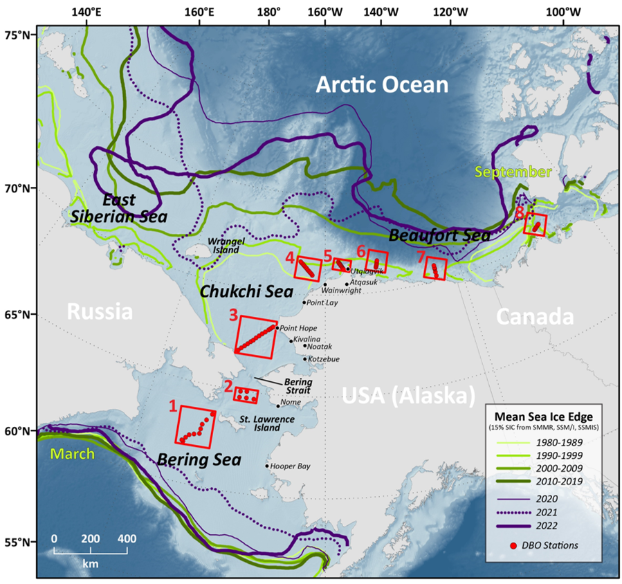
Data Discovery
Explore this data using NASA's Earthdata Search, a comprehensive tool for discovering and visualizing Earth science datasets.Data Access
Access requires an Earthdata Login account. Read our guide on obtaining AWS credentials to retrieve this data from AWS.Update Frequency
Varies by dataset
License
Documentation
Managed By
![]()
See all datasets managed by NASA.
Contact
https://earthdata.nasa.gov/contact
How to Cite
NASA MISST Project was accessed on DATE from https://registry.opendata.aws/nasa-misst.
Resources on AWS
-
- Description
- SAILDRONE_ARCTIC_2021 v1 - The Saildrone Arctic 2021 dataset presents a unique collection of high-quality, near real-time, multivariate surface ocean, and atmospheric observations obtained through the deployment of Saildrone, an innovative wind and solar-powered uncrewed surface vehicle (USV). Saildrone is capable of extended missions lasting up to 12 months, covering vast distances at typical speeds of 3-5 knots and operates autonomously, relying solely on wind propulsion, while its navigation can be remotely guided from land.
- Resource type
- S3 Bucket Controlled Access
- Amazon Resource Name (ARN)
arn:aws:s3:::podaac-ops-cumulus-protected/SAILDRONE_ARCTIC_2021- AWS Region
us-west-2
-
- Description
- SAILDRONE_ARCTIC_2022 v1 - The Saildrone Arctic 2022 dataset presents a unique collection of high-quality, near real-time, multivariate surface ocean, and atmospheric observations obtained through the deployment of Saildrone, an innovative wind and solar-powered uncrewed surface vehicle (USV). Saildrone is capable of extended missions lasting up to 12 months, covering vast distances at typical speeds of 3-5 knots and operates autonomously, relying solely on wind propulsion, while its navigation can be remotely guided from land.
- Resource type
- S3 Bucket Controlled Access
- Amazon Resource Name (ARN)
arn:aws:s3:::podaac-ops-cumulus-protected/SAILDRONE_ARCTIC_2022- AWS Region
us-west-2